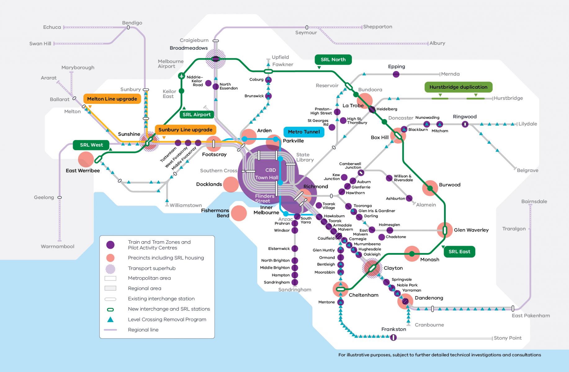
Activity Centre Program
Activity Centres are a cornerstone of the Victorian Government’s planning changes designed to fast-track higher-density housing in sixty locations across Melbourne and nine regional cities close to transport and services.
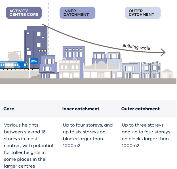
Activity Centres generally consist of a central “core” area and surrounding “catchments”. In many centres, higher-rise development up to 20 storeys is proposed within the core at train stations, some tram stops and shopping strips.
Catchment areas include residential streets up to 10 minutes walk from the core. They are rezoned for 3 to 6 storey apartments and townhouse development based on their proximity to transport, jobs and services.
In total, 60 Activity Centres have currently been identified across Melbourne, with a target of 300,000 new dwellings by 2050 and early plans indicate that even more centres, up to 150 more, may follow.
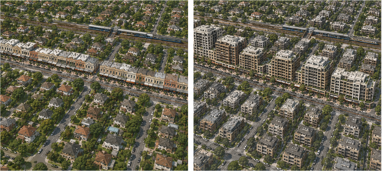
Conceptual illustration showing the broad change in built form that may occur under the Activity Centre model. Illustrative only and not intended to depict a specific location.
Rapid rollout at scale
While presented as “well-located growth,” the scale and speed of this rollout are unprecedented raising serious concerns about the lack of proper analysis, infrastructure planning, and community input.
The first 10 “pilot” Activity Centres were introduced in 2024 and came into effect in April 2025. Since then, further centres have been announced across Melbourne, often grouped together for consultation purposes, limiting the ability of communities to respond meaningfully.
Built Form Overlay: the new “core” control
At the core of each Activity Centre are new planning rules, the Built Form Overlay (BFO). This determines what can be built, including building heights, setbacks, and street wall requirements. In practice, if a development meets these preset standards, councils are required to approve it.
This represents a fundamental shift in planning power. Local councils are reduced to administrative roles, and community members lose long-standing rights to notice and objection or to challenge decisions at VCAT.
If a proposal complies with the prescribed rules, it is effectively guaranteed approval, regardless of broader impacts and local context. This may lead to increased overshadowing of public spaces and more generic building designs, eroding the distinctive character that defines Melbourne’s shopping strips today.
Building heights can be mandatory (fixed) or discretionary (exceeded if there is a public benefit). In the six cores approved in Boroondara to date all heights are discretionary.
There are already multiple approvals by the Minister for Planning where heights have been exceeded by up to four storeys. Affordable housing contributions have been included in the development although there is no guarantee they will be delivered. See information on the Development Facilitation Program for more detail.
Walkable catchments and expansion into surrounding neighbourhoods
Beyond the core areas, surrounding residential streets within a walkable catchment of approximately 800 metres (commonly described as a 10-minute walk) are rezoned into the new Housing Choice and Transport Zone (HCTZ), which was created specifically to facilitate increased density and housing choice in these locations.
The HCTZ is intended to provide a medium-density transition zone between higher-density development in activity centre cores and lower-density residential neighbourhoods beyond the catchment boundaries. It is divided into two areas:
- HCTZ1 (Inner Catchment): Allows buildings of up to 4 storeys on most sites and up to 6 storeys on larger lots.
- HCTZ2 (Outer Catchment): Allows buildings of up to 3 storeys on most sites and up to 4 storeys on larger lots.
Large lots are generally defined as sites of at least 1,000 square metres with a minimum 20-metre frontage and may be created through the consolidation of multiple lots.
These zones permit significant increases in density across established residential neighbourhoods. Large-scale site consolidation is anticipated, along with increased pressure on homeowners to sell.
While the stated purpose of the HCTZ is to increase housing supply and diversity in locations close to public transport, jobs and services, the zone makes no reference to neighbourhood character or heritage. By contrast, the Neighbourhood Residential Zone (NRZ) and General Residential Zone (GRZ), which previously applied to many residential streets now rezoned to the HCTZ, include objectives relating to neighbourhood character and heritage.
Existing protections embedded within current residential zones are removed or weakened, creating uncertainty about how historic streetscapes and local identity will be preserved.
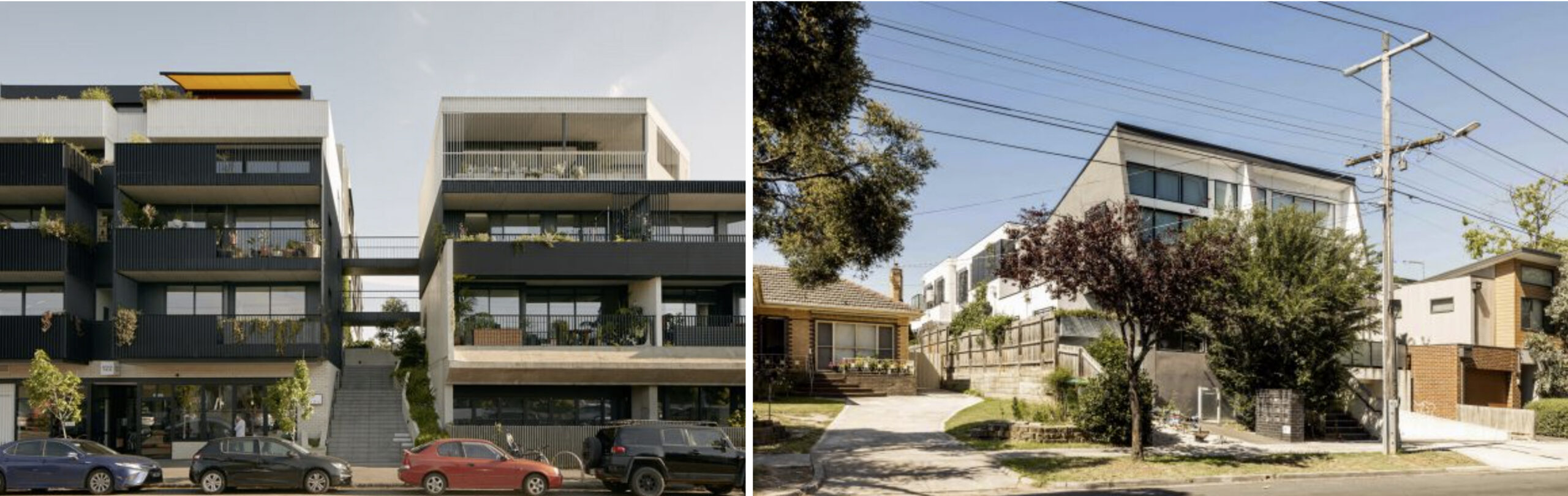
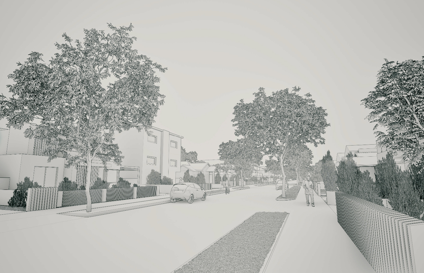
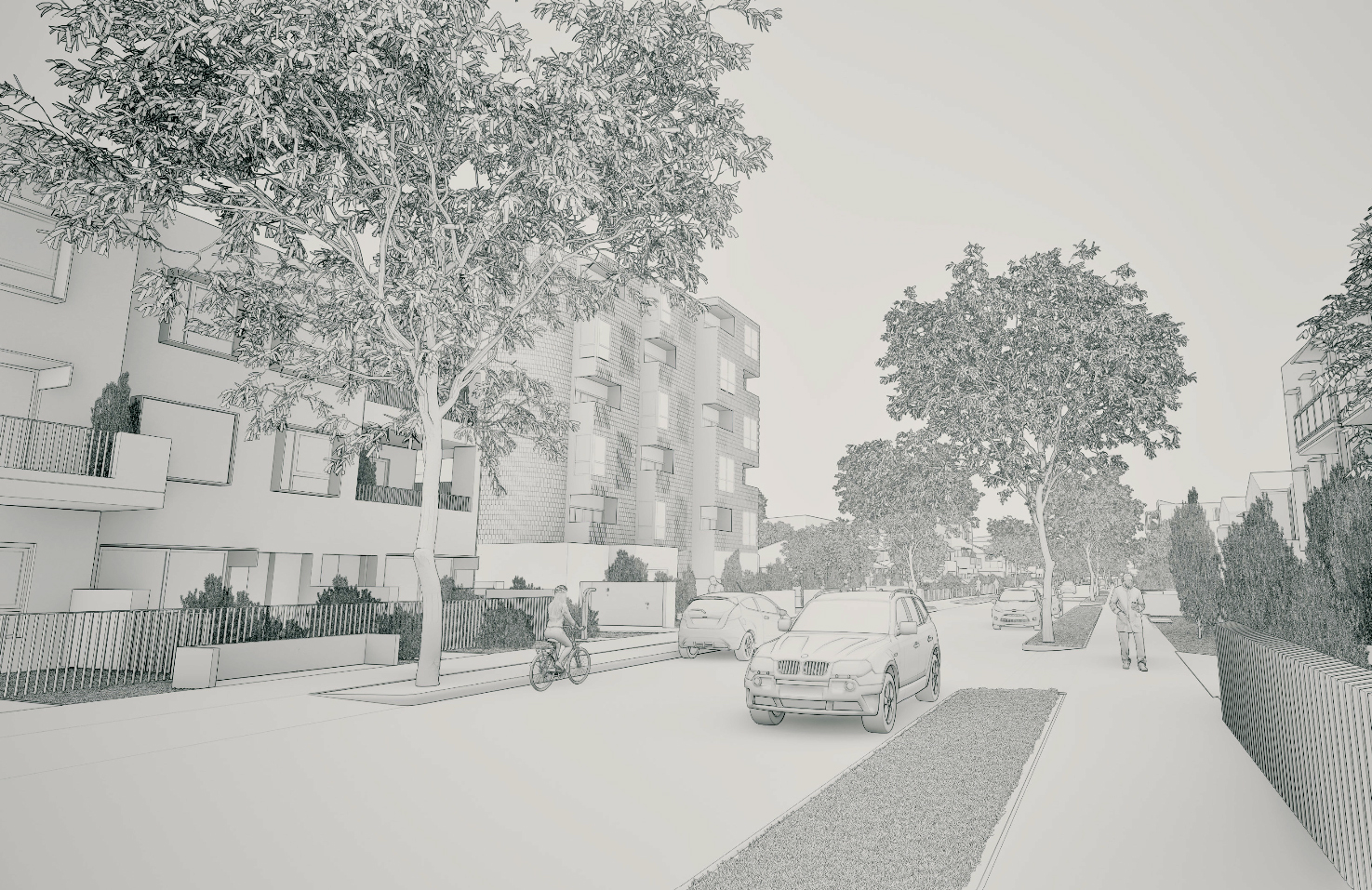
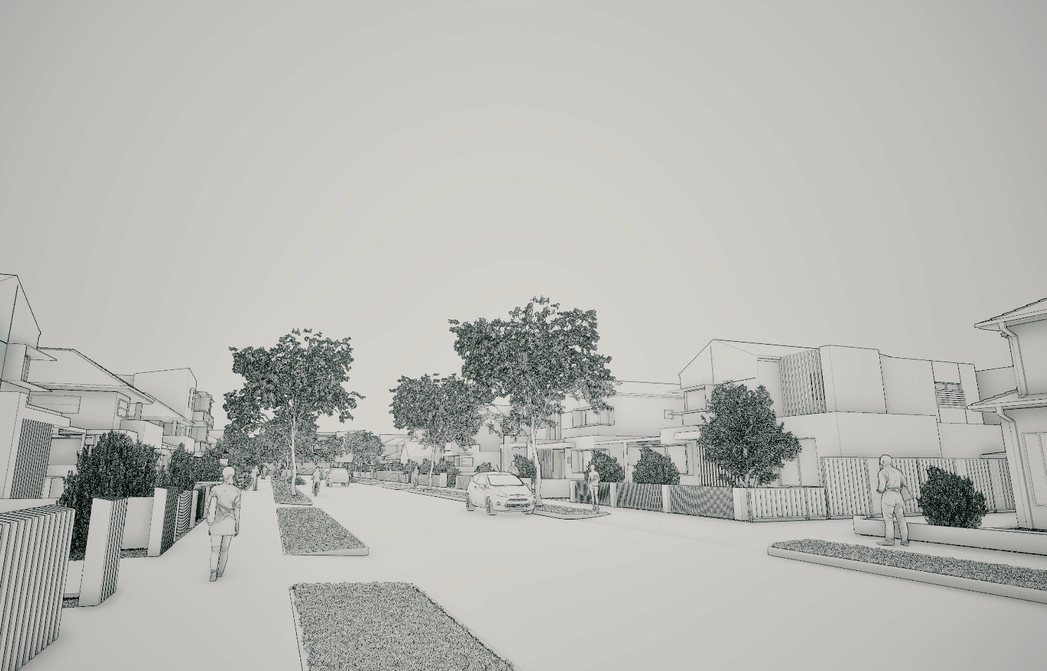
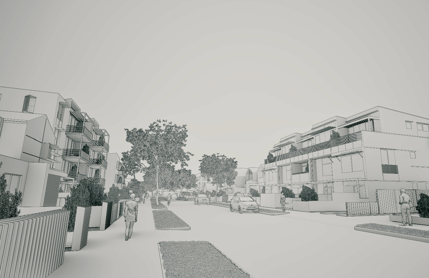
Department of Transport and Planning (DTP) examples of an inner and outer catchment.
Current and future views
The Department of Transport and Planning images below depict how both an inner and outer catchment may evolve over the next 30 years.
Note that the ‘current’ streetscapes shown do not accurately represent Boroondara’s residential areas, where generous front and side setbacks, mature gardens and established tree canopy are defining characteristics. This has the effect of downplaying the extent of change when comparing the ‘current’ and ‘future’ images.
Standardised codes and reduced scrutiny
At the same time, new state-wide building codes, the Townhouse and Low-Rise Code (up to 3 storeys) and the Mid-Rise Code (4-6 storeys) introduce “deemed to comply” building standards to further streamline approvals. Objections are effectively limited to technical compliance, and appeal rights to VCAT are lost.
The result is a highly standardised, one-size-fits-all approach applied across vastly different suburbs. Distinctive shopping strips and neighbourhoods risk being replaced by generic, “cookie-cutter” developments that fail to respond to local context. Of particular concern is the lack of “place planning”.
Growth without clear supporting commitments
More broadly, the Activity Centre model concentrates large amounts of growth into a limited number of suburbs, with no commitments to the infrastructure, services, or affordability measures needed to support that growth. It reflects a “supply at all costs” approach, prioritising speed and volume over quality, liveability, and fairness.
Payable from 2027 onwards, the Infrastructure Contribution Plan (ICP) requires developers to pay a fee of $11,350 per dwelling with Councils keeping $7,567 (in 2026-27) and the State government $3,783 per dwelling.
This money is intended to fund infrastructure upgrades to both local and state infrastructure. Local infrastructure includes upgrades to local roads and intersections, footpaths, drainage, bike paths and walking trails, recreation and community infrastructure, street tree planting, parks and playgrounds. State infrastructure includes upgrades to major roads, public transport infrastructure, schools, health facilities, emergency services and public realm improvements.
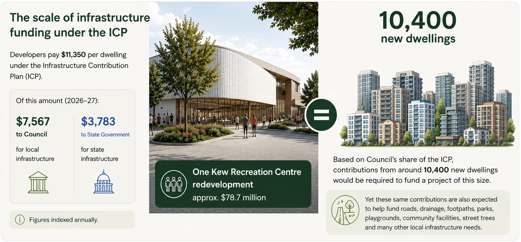
The scale of infrastructure funding required is difficult to appreciate until real projects are considered. The Kew Recreation Centre redevelopment alone has a budget of approximately $78.7 million. At the current ICP rate, councils would need contributions from around 10,400 new dwellings to fund a project of this size. Yet the ICP is expected to contribute towards roads, drainage, footpaths, parks, playgrounds, community facilities, street tree planting and many other infrastructure needs.
This raises serious questions about whether the funding available will be sufficient to maintain existing levels of amenity as populations increase. The challenge is even greater when considering the acquisition of new public open space, where land costs in established suburbs can run into tens of millions of dollars for a single hectare.
What this means for Melbourne
This is not simply about increasing housing. It is about who controls planning, whose voices are heard, and what kind of city Melbourne is becoming.
Most Melburnians accept that the city will continue to grow. The challenge is ensuring that growth is well planned, supported by infrastructure, respectful of local character and informed by meaningful community engagement.
A successful planning system should balance housing supply with liveability, sustainability and fairness. It should create places people want to live in, not simply deliver dwelling targets.
The future of Melbourne will be shaped not only by how many homes are built, but by the quality of the neighbourhoods that remain.